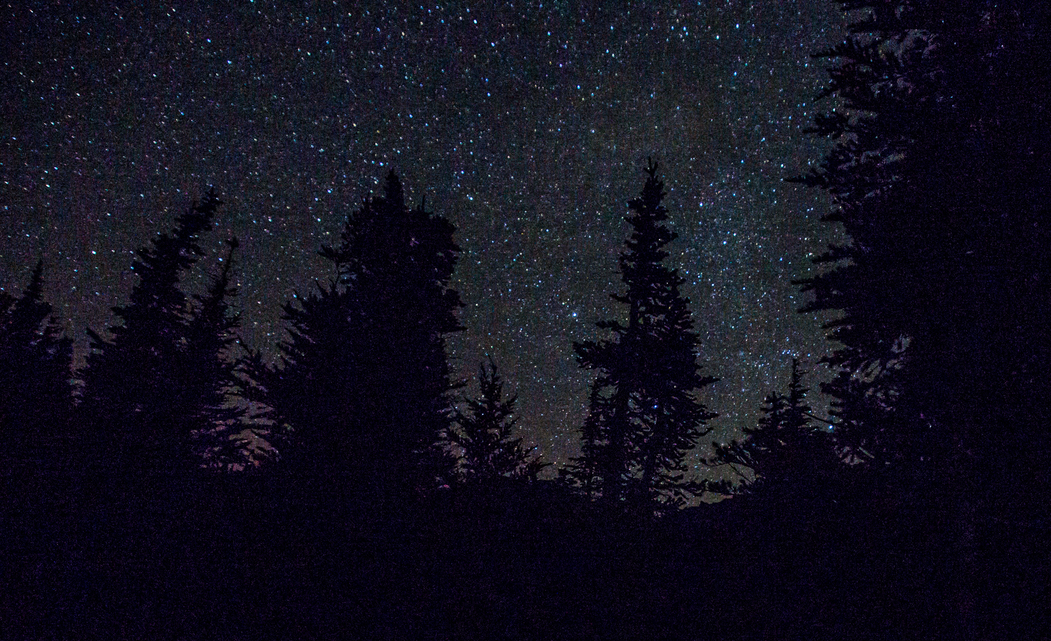
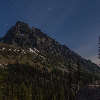
Clear skies Friday night
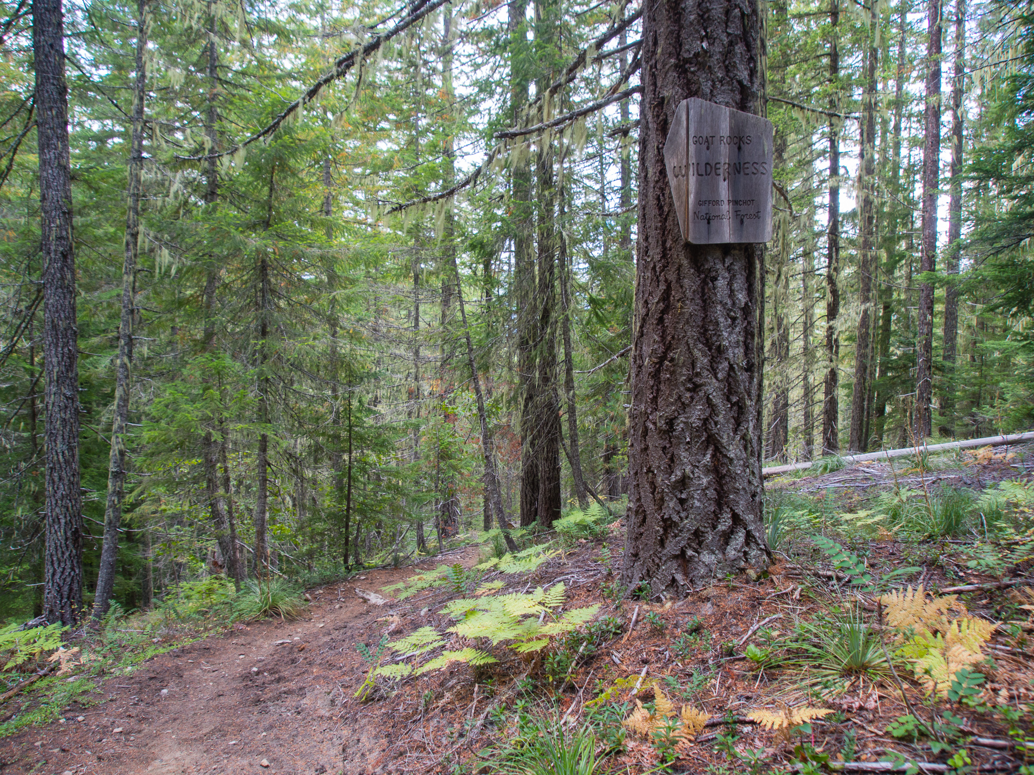
For my third trip of the summer to Seattle I picked Goat Rocks Wilderness as a destination since I’d heard great things, but had never made it down that way before. Goat Rocks is situated in a pretty awesome location between Mount Rainier and Mount Adams. Our friend Tom had the weekend off of work so he was able to join me on the trip.
My plane landed in Seattle around 5:30pm Friday evening and Tom was there to pick me up. We were headed south on I-5 shortly thereafter. After a quick bite to eat at the Naches Tavern (delicious burgers!) and a very long journey along forest roads we were finally at the Snowgrass Flats trailhead. We had picked a loop hike through the wilderness area for the weekend that we found off of WTA’s website: Cispus Basin and Cispus Pass.
By the time we made it to the trailhead it was almost 10pm and it was quite dark out. The moon had already set so we relied on our headlamps for navigation. I was surprised that we saw a couple of other groups at the trailhead getting ready to head out into the dark as we were disembarking. Unfortunately, I have no photos for the first 5 miles of this hike since they were trekked in the dark. There wasn’t much to look at besides making sure my feet were tripping over any roots. But, this part of the trail was really easy to navigate by headlamp and we made quick time. I recently acquired a new headlamp through a contest on Yonder and it has a red mode to help you keep your night vision which I used for most of the hike in.
Flying for backpacking poses a couple of logistical issues. The biggest ones for me are that I can’t pack fuel for my Jetboil or water in my MSR bladder. I’ve been lucky enough to have my friends be able to grab fuel for me before I arrive, but water posed a problem on this trip. I neglected to fill up at the airport or at dinner so I didn’t have any water for the first couple of miles. My plan was to hike to the Goat Creek crossing 1.8 miles in to fill up. We made it to the crossing without issue, but I’m not the fastest at filtering with my current setup. I recently switched to using a Sawyer Mini water filter to cut down on weight. But I only have a 16oz bag for it which means after every 16oz I filter I have to unhook the filter and refill the squeeze bag. As I crouched next to the stream slowly filtering I felt bad for making Tom stand around in the dark so long. I also made a mental note to invest in a larger squeeze bag for the Sawyer since my slow speed has been a burden on my last two trips.
Directly on the other side of the bridge over the creek there were a couple of backpackers setting up camp for the night. Taking a nap sounded really good after a day of work, a flight to Seattle, a long car ride, and a couple miles of backpacking but we wanted to get further in before setting up camp so we could wake up in the alpine.
As we cranked out the miles beneath the cloak of night I was abruptly alerted by a noise in the bushes to my right. My initial instinct was that it was a bear so I started shouting into the ether and slowed down so Tom and I would be close. Tom came up behind me and asked what was going on, I told him there was a bear or something and we both shouted a little bit. Then, in the distance, I saw two red glowing eyes starring back at me. I asked Tom if he could see the glowing red eyes, but he said he could only see white eyes. After being confused for a brief second we realized that the red light in my headlamp was reflecting back at me. Then the creature moved forward and we could see the big scary beast was actually a tiny little deer.
After our scary deer moment we continued on until taking a left onto the Lily Basin trail towards Alpine Camp. I really had no idea what to expect of Alpine Camp besides a little waypoint on our map. Since there were a lot of cars at the trailhead I worried that we wouldn’t be able to find a spot to camp. Our worries grew as each campsite we found was taken. Most of them were set back a ways from the main trail so we’d sneak in quietly to see if it was available only to turn around as soon as a tent reflected back at us. At 5.4 miles in we found an open campsite and quickly fell asleep. I used my Outdoor Research Helium Bivy for this trip and loved sleeping with my head out in the open with the Milky Way flowing above me.
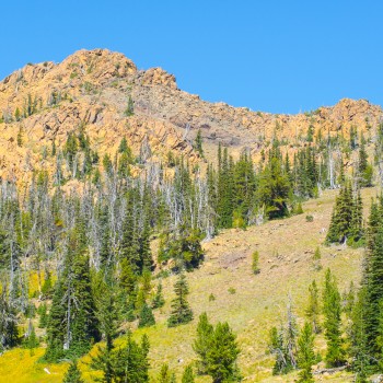
Goat Creek cascading down from Goat Lake across the basin
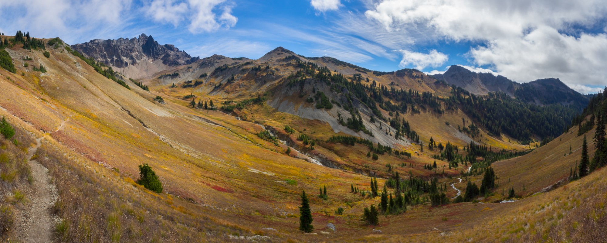
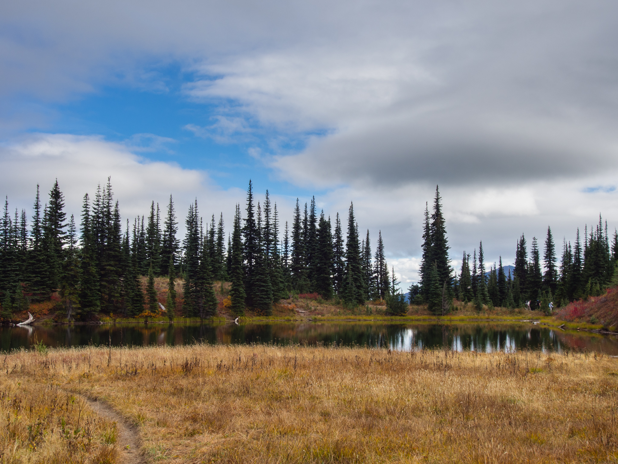
When I awoke the next morning I found we were in an alpine wonderland. We were nestled in the trees and the back of our campsite had an amazing view across Goat Basin. Through the trees I could even make out Goat Creek coming down the other side of the valley.
We started up breakfast and soon the Gray Jays were all over our campsite. I had my sleeping bag hanging from a tree and had to keep shooing them away to make sure none of them would poop on my bag! But then I’d turn around and another one would be trying to steal my food. You can definitely tell that people have been feeding them and they’re habituated.
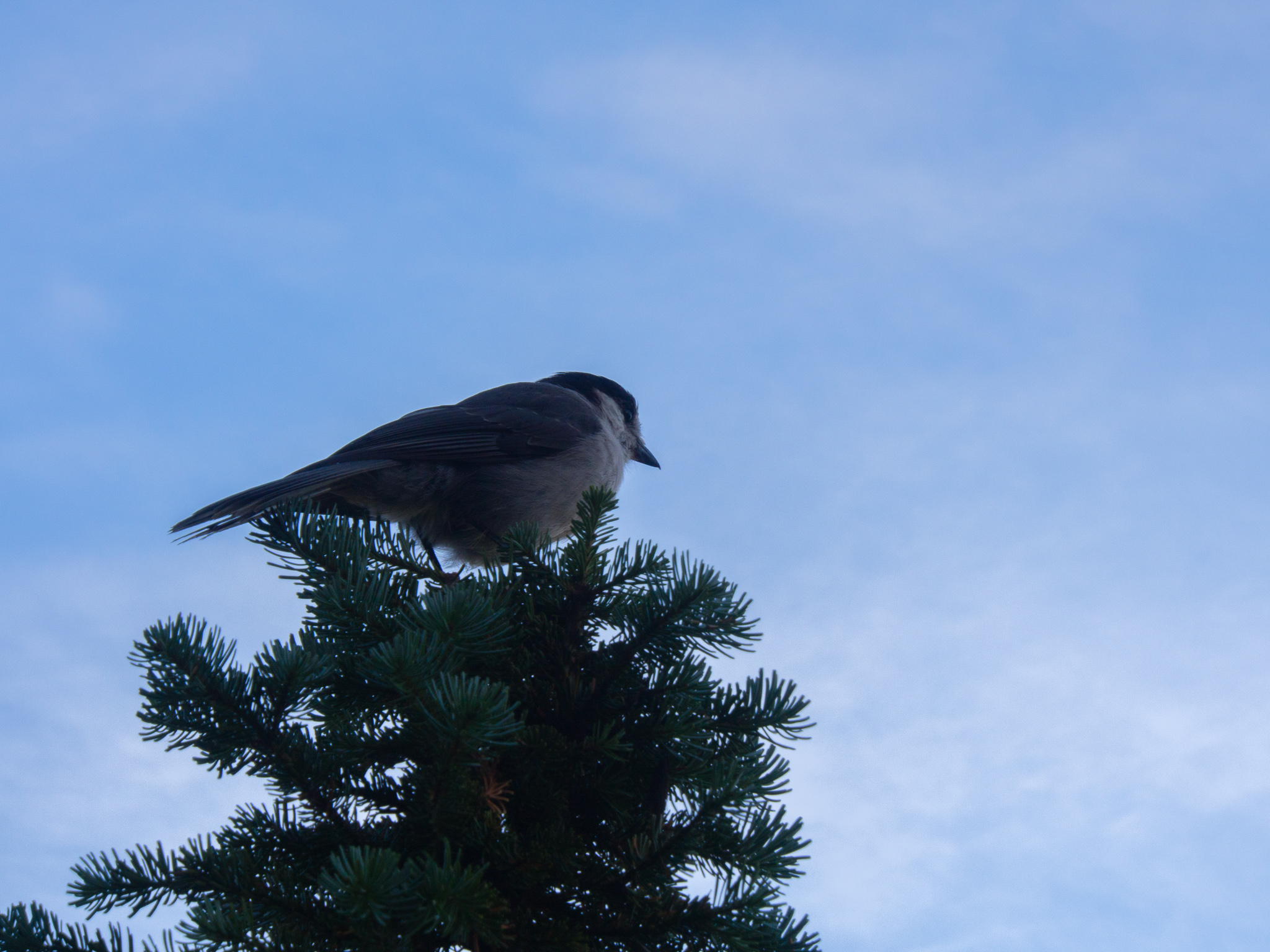
The Gray Jays surrounded us during breakfast
Leaving our campsite I turned to the south to see Mount Adams dominating the horizon. Hiking in the dark definitely gives you surprises in the morning! There’s a small spring that runs through Alpine Camp where we filled up our water. I found that I was getting much faster with my Sawyer and filled up in no time.
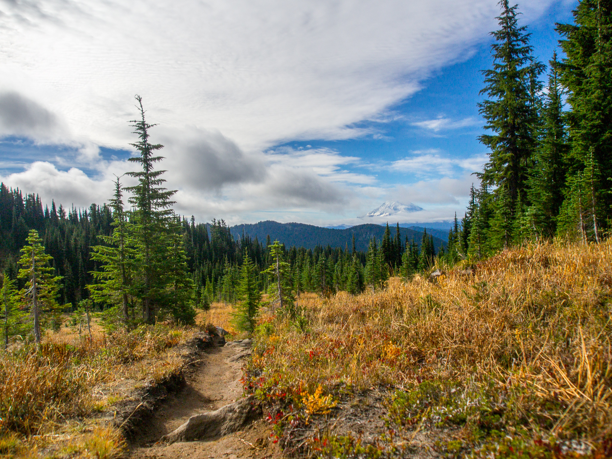
Lily Basin Trail through Alpine Camp with Mount Adams in the distance
We also found that there are a lot of campsites at Alpine Camp. I lost count and as we continued on the trail we passed even more sites. I was surprised to find very little trash in the area and it seemed to be well taken care of.
Across from the spring where we pumped water there was a little trail with two signposts. Both signs had fallen off the posts but based on the direction the trail headed we assumed it would meet up with the main trail that would take us up to the Pacific Crest Trail. Our assumptions were right, but I was disappointed to find that after we joined up with the main Snowgrass Flats trail there was a little sign signaling that the trail we had used was closed for restoration. It would’ve been nice if that signage was on both ends of the trail! So if you reference our GPX, go back to the main trail from camp instead of using the one we used.
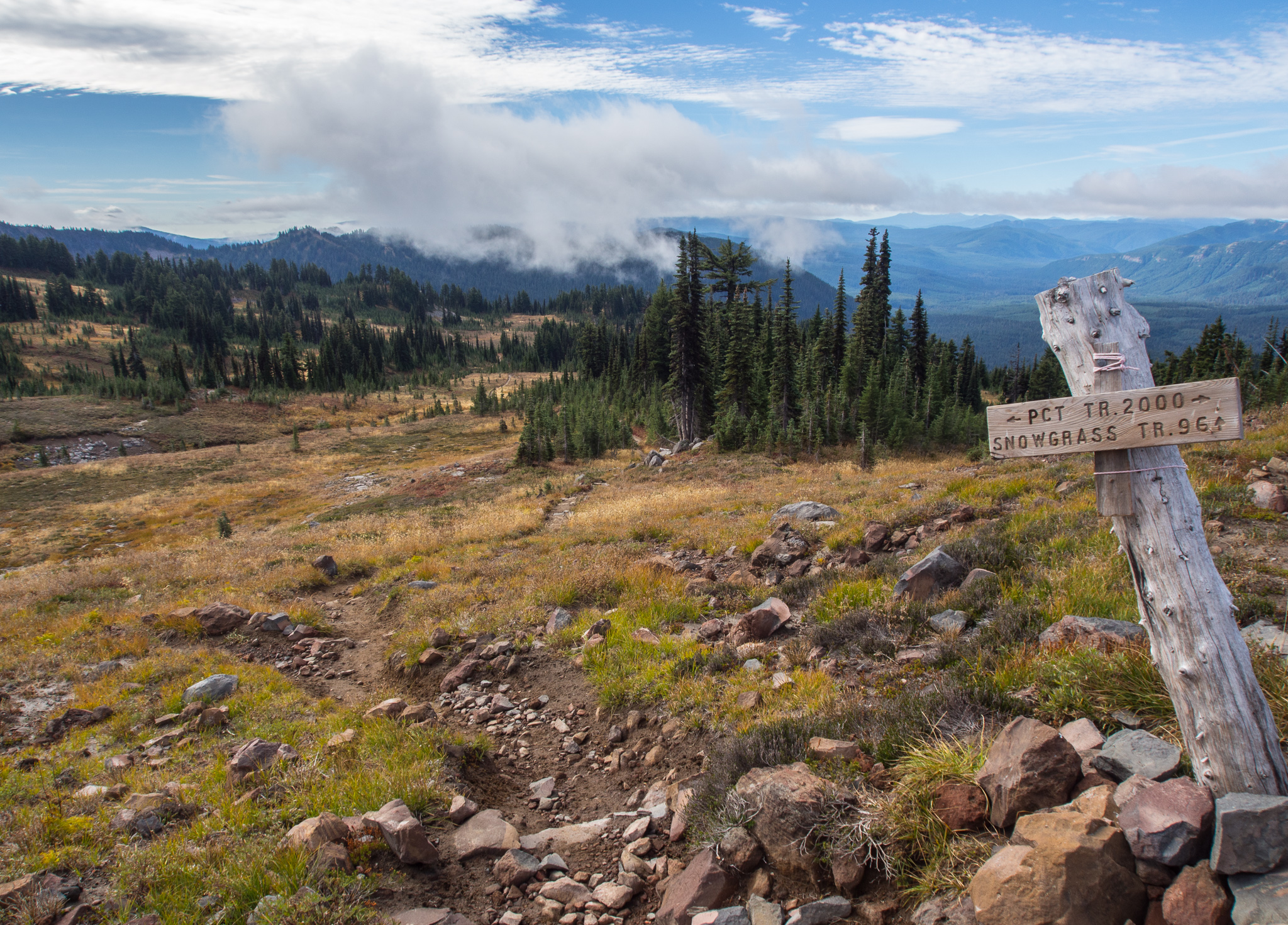
Intersection with the PCT
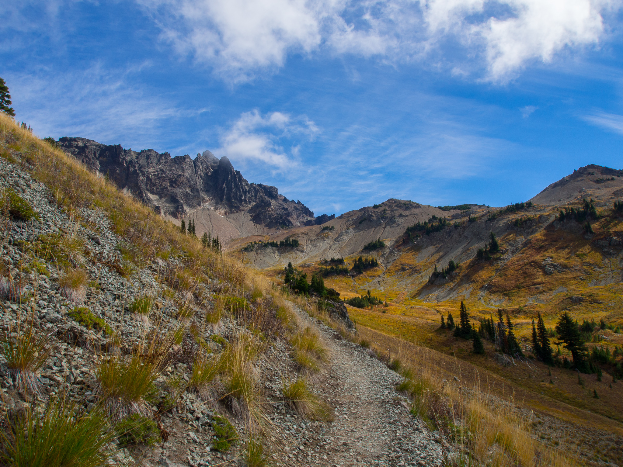
After passing a half dozen more campsites along the Snowgrass Flats trail we reached the intersection with the PCT in a beautiful open meadow with ancient volcano spires above. They say these mountains are remnants of a large volcano that has been extinct for 2 million years and was over 12,000 feet tall. That volcano has eroded away to the peaks we see today. It’s fun to imagine what Mount Adams and Mount Rainier will look like in 2 million years. Will new volcanoes rise up to replace them?
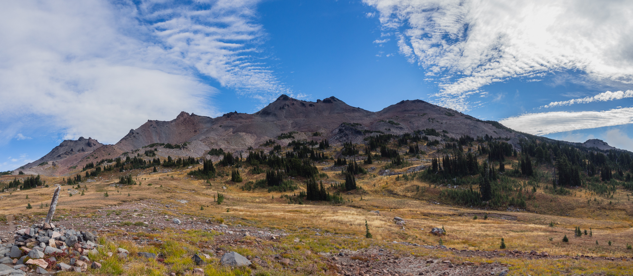
Old Snowy Mountain and Ives Peak
Our travel on the PCT was flat and easy. Heading south we reached the most ambitious trail retaining wall I’ve ever encountered. The talus slope above the trail had been stacked for 3-4 feet to allow rock-free passage. This part of the trail is also where we passed a guy who I’m assuming was a thru-hiker who was rocking the longest kilt I’ve ever seen.
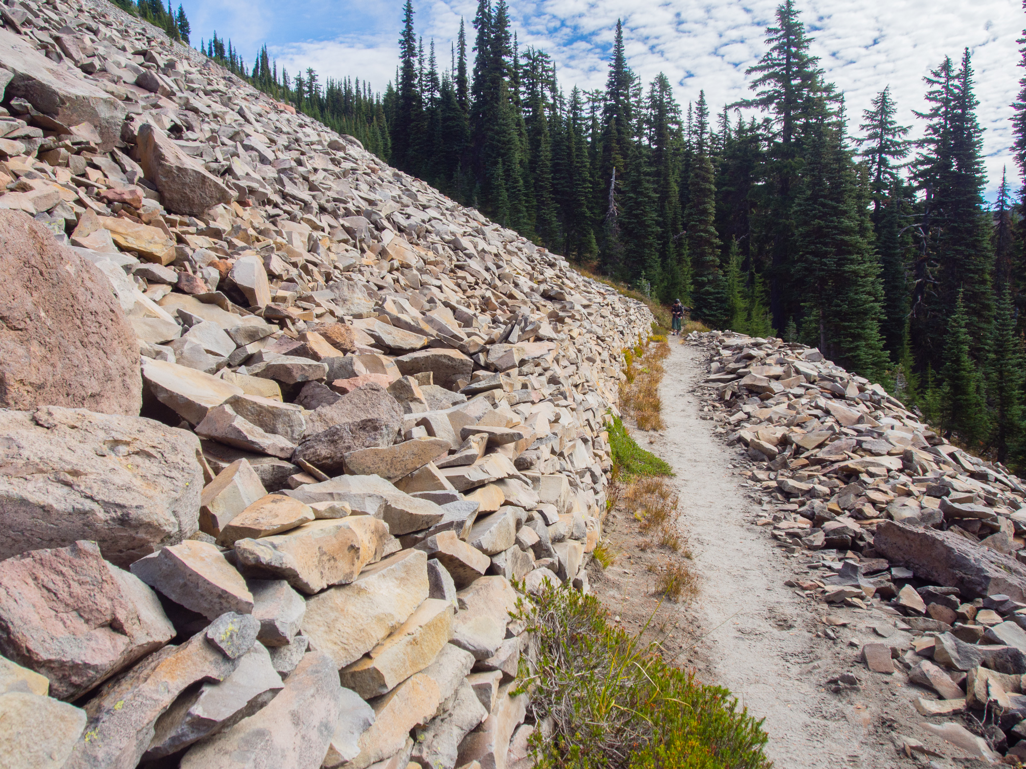
The most impressive retaining wall I’ve ever seen on a trail
A bit further along we passed a bow hunter decked out in camouflage. I asked him if he’s seen anything and he said he’d been out since Tuesday and that he’d seen some Elk but they weren’t close enough for him to shoot. I asked him what he’d do if he ever shot one and he said he’d carry it out on his back. I was quite impressed that he’d be able to carry an entire Elk on his back, but then he informed me that he’d cut it up into pieces and take multiple trips. I told him he was much more ambitious than I am. I can’t imagine having to take 4 trips in and out with all of that weight on my back! Sometimes online there’s a lot of animosity between hunters and hikers so it was great to have such a positive interaction on the trail. After all, we’re all out there for the same basic reasons, we just enjoy it in slightly different ways.

Our first view of Cispus Basin. Big Horn is the peak that looks highest with Goat Citadel being the flatter peak to the right.
Eventually the PCT took us to an overlook at the edge of Cispus Basin. The view up the basin was amazing and reminded me why I love the Cascades so much. Tom and I had discussed trying to scramble a peak so we were looking at the ridge line scoping out which one was our objective – Gilbert Peak. We decided it wasn’t visible from this vantage and we continued on. I had a route description for the peak from my Fred Beckey book which was pretty vague.
Pacific Crest Trail enters Cispus Basin
We wandered on towards the head of the basin where Fred claimed we would follow a rock escarpment to the top of a ridge. The PCT crossed Cispus Creek here so we took a break for lunch before starting our trek cross country towards the craggy peaks above. We assumed the ‘rock escarpment’ Beckey describes is the creek bed.
PCT towards Cispus Pass
At this point we left the PCT, but we would rejoin it later. If you follow our GPX and don’t feel like adding elevation and distance to your trip, you should stick to the PCT and follow it up to Cispus Pass.
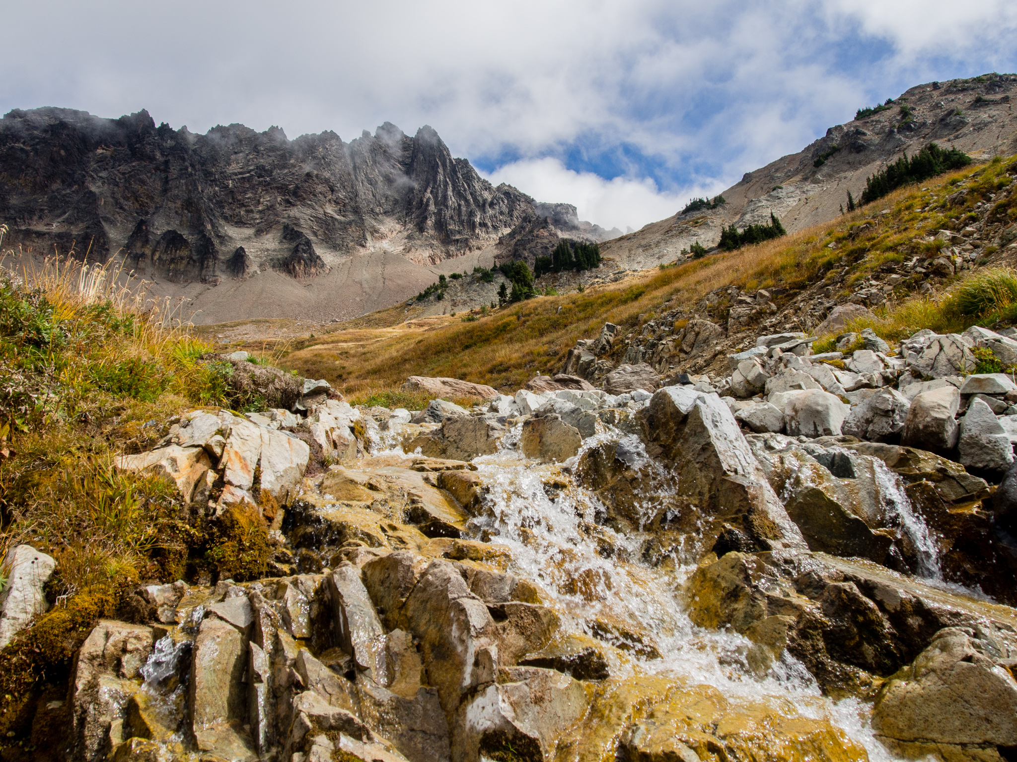
Cispus Creek
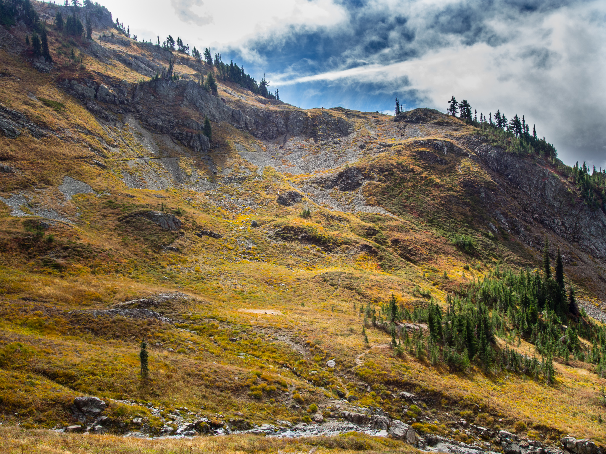
Our steep cross country travel went slowly and we eventually reached a high plateau with another campsite. But based on all of the ruts from runoff I wouldn’t want to be there in a storm. There were also a couple of campsites lower in the basin right off the PCT which would make an awesome place to spend the night. Actually, when I was boarding my plane in Minnesota for Seattle the guy behind me on the jetway asked me if I was a backpacker and when I told him where we were going he recommended one of the campsites in this basin.
Cross country travel
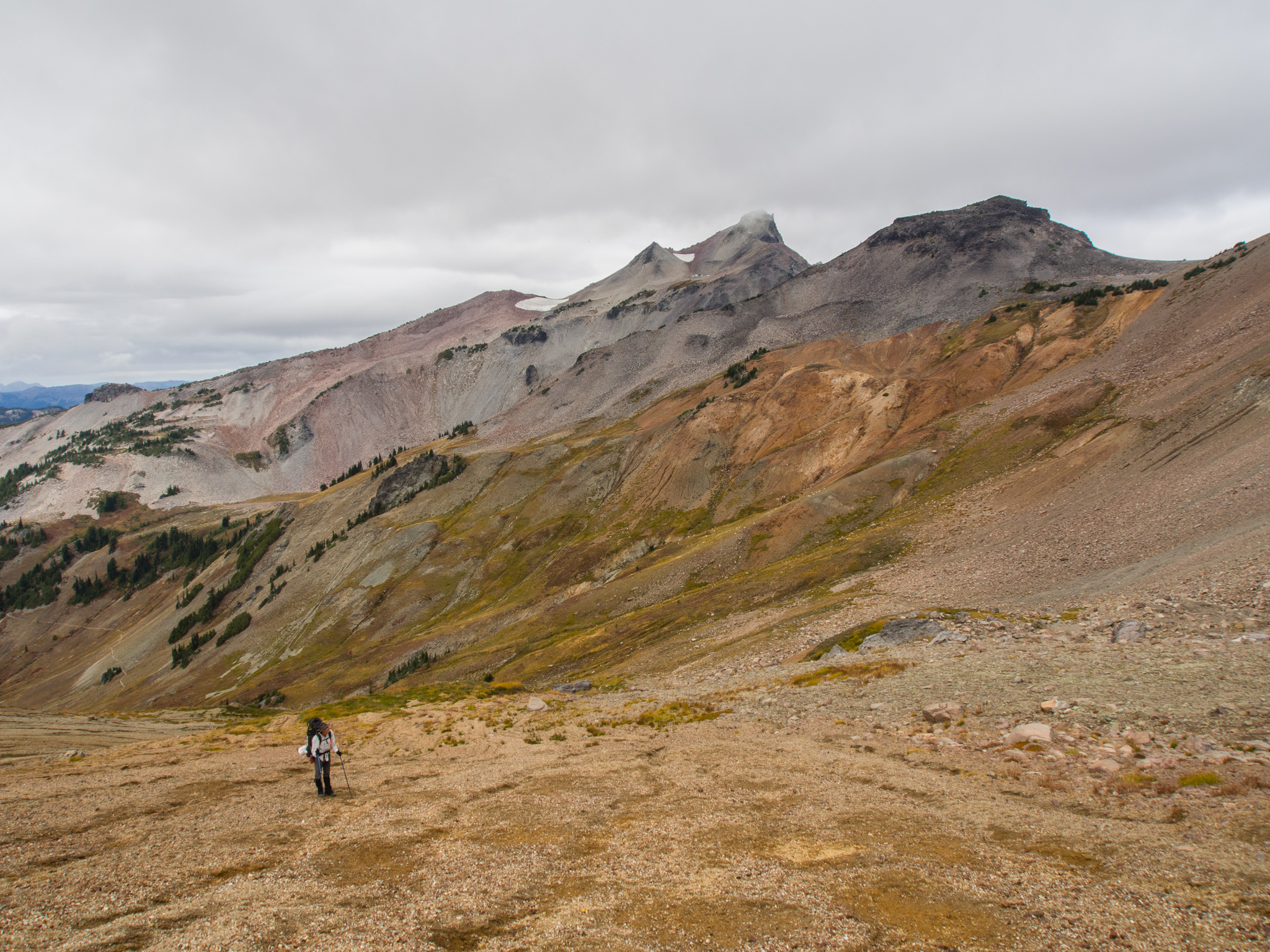
We continue up to the saddle taking the path of least resistance. The route description to Gilbert Peak said that at the top of the saddle we would traverse under a cliff band and then ascend a ‘broad rotten gully’. At the top of the saddle we spotted a couple of people near the top of Little Horn (next to Big Horn) along with some 40 goats across Cispus Basin. But, we didn’t see an obvious way up the ‘broad rotten gully’. We saw some other climbers slowly picking there way through the lose rock and Tom and I both agreed that it didn’t look like our idea of fun. Plus, clouds were rolling in and visibility was quickly deteriorating. We agreed to skip the peak and hike back to Cispus Pass via goat trails on the ridge to avoid backtracking.
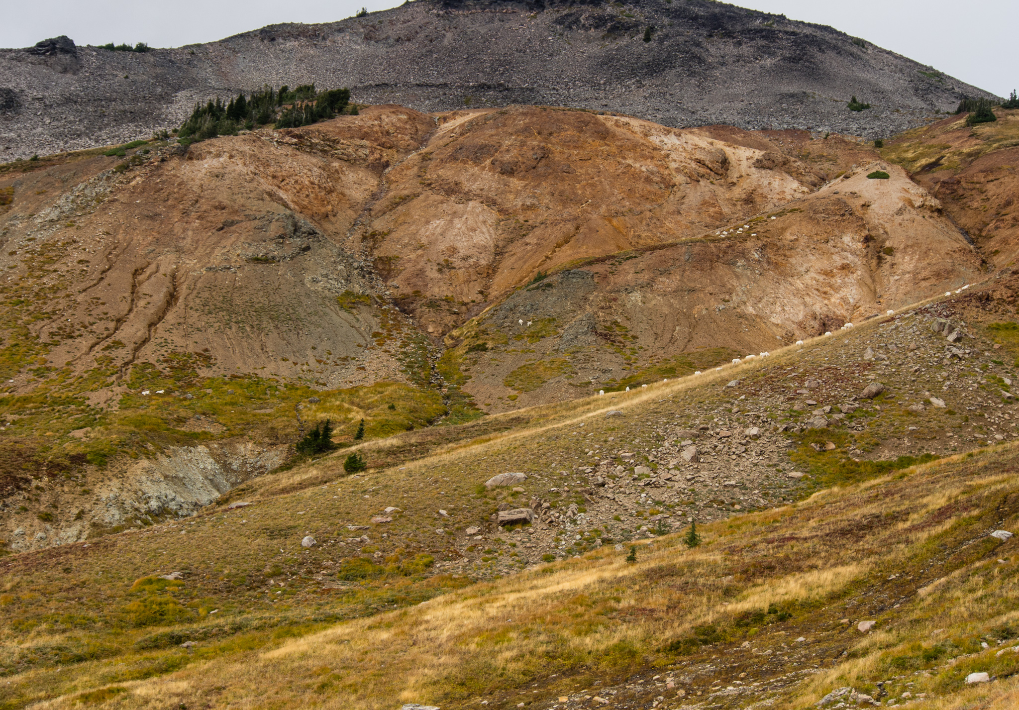
At least 40 goats in the distance.
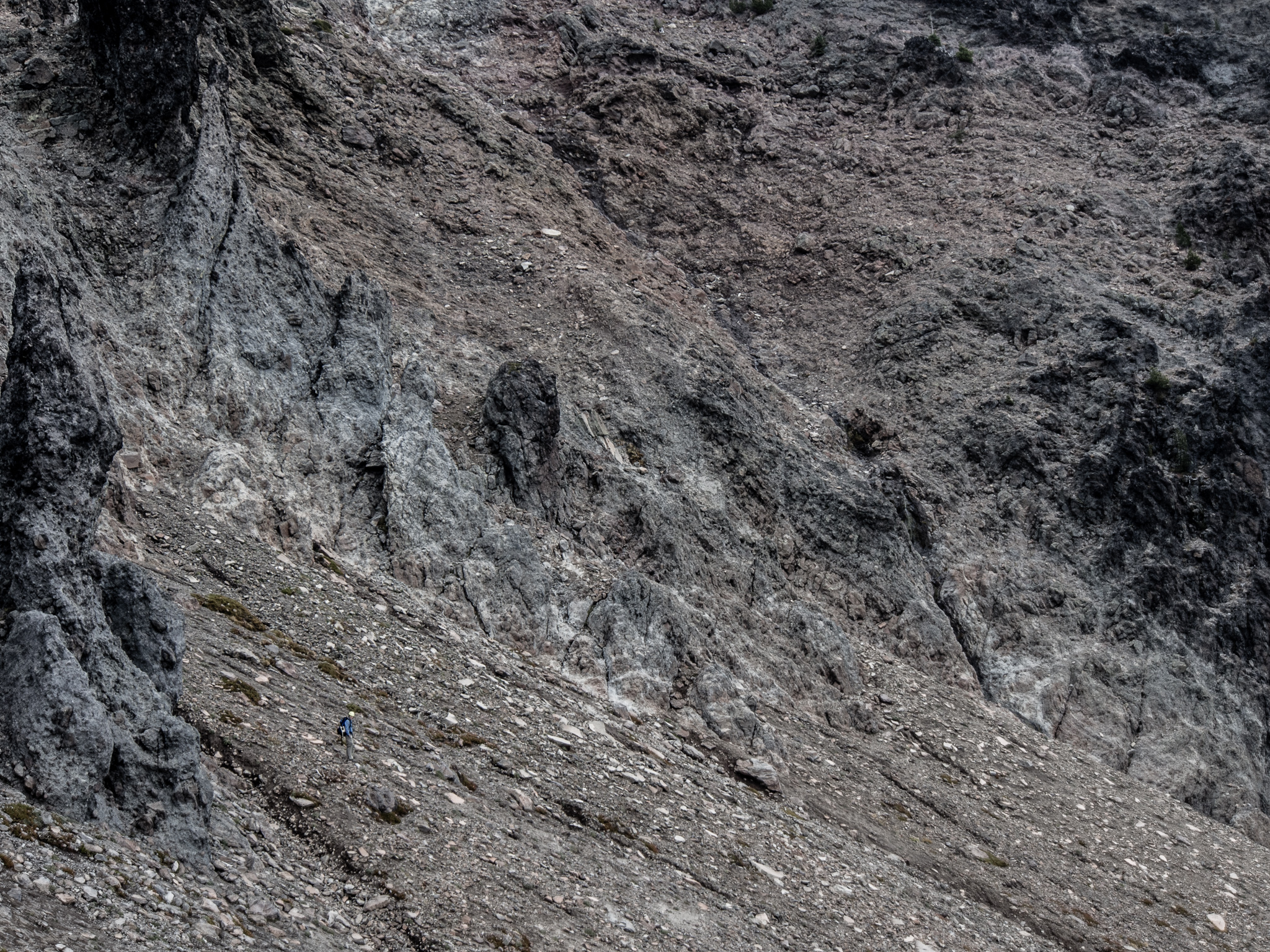
Beckey’s “Broad Rotten Gully” to the right. Climber in the bottom left for scale.
After crossing moderately steep scree slopes we debating the best route forward as the terrain steepened. From along the ridge we were following a young couple emerged in the distance. I didn’t think we’d be able to travel across the section of ridge they were coming up to, but after seeing them cross it with ease I was excited to know we had a straightforward path ahead of us. We chatted with the couple for a bit and they seem optimistic about being able to climb the gully we backed off on. They were prepared with helmets but no other supplies. The clouds were completely obscuring the summits by this point, but they continued ahead anyway.
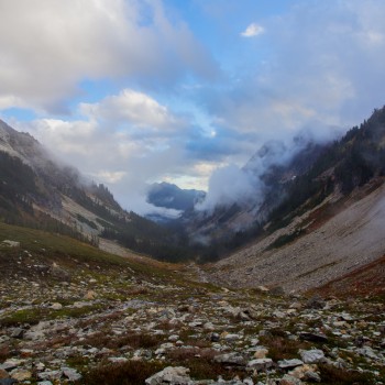
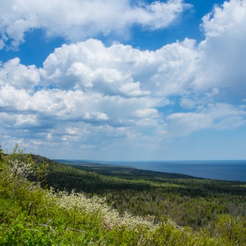
Klickitat Basin and Klichitat Creek lie on the opposite side of the ridge from Cispus Pass. From the saddle of the ridge we had beautiful views down both valleys. We could also see some scattered showers in the distance, but we managed to avoid any precipitation.
Scattered showers down Klickitat Basin
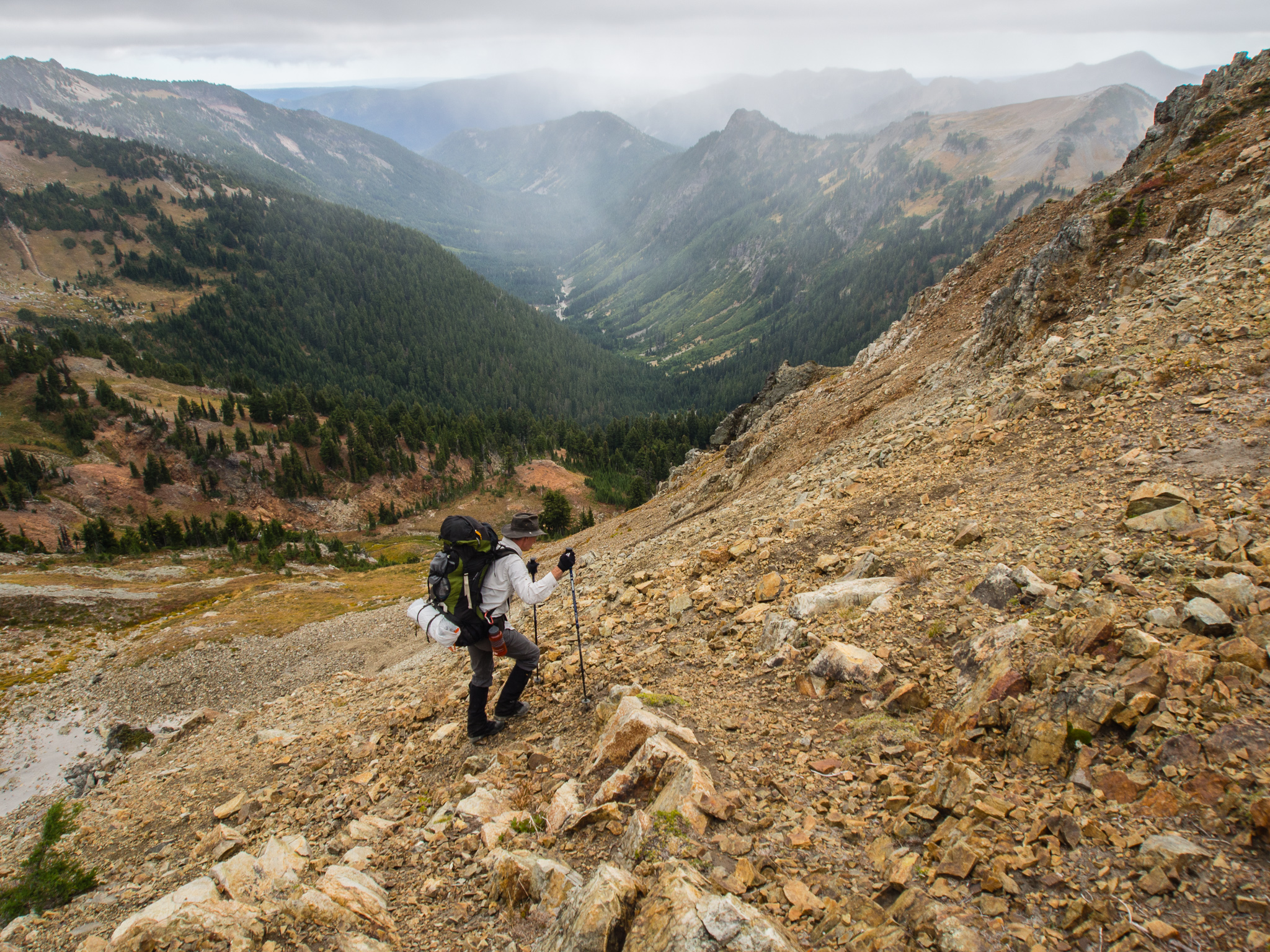
We made our way down to Cispus Pass through steeper terrain and found ourselves back on the PCT. As we continued south on the trail we crossed the edge of the Yakima Indian Reservation. Numerous signs warned us to stay on trail to avoid trespassing.
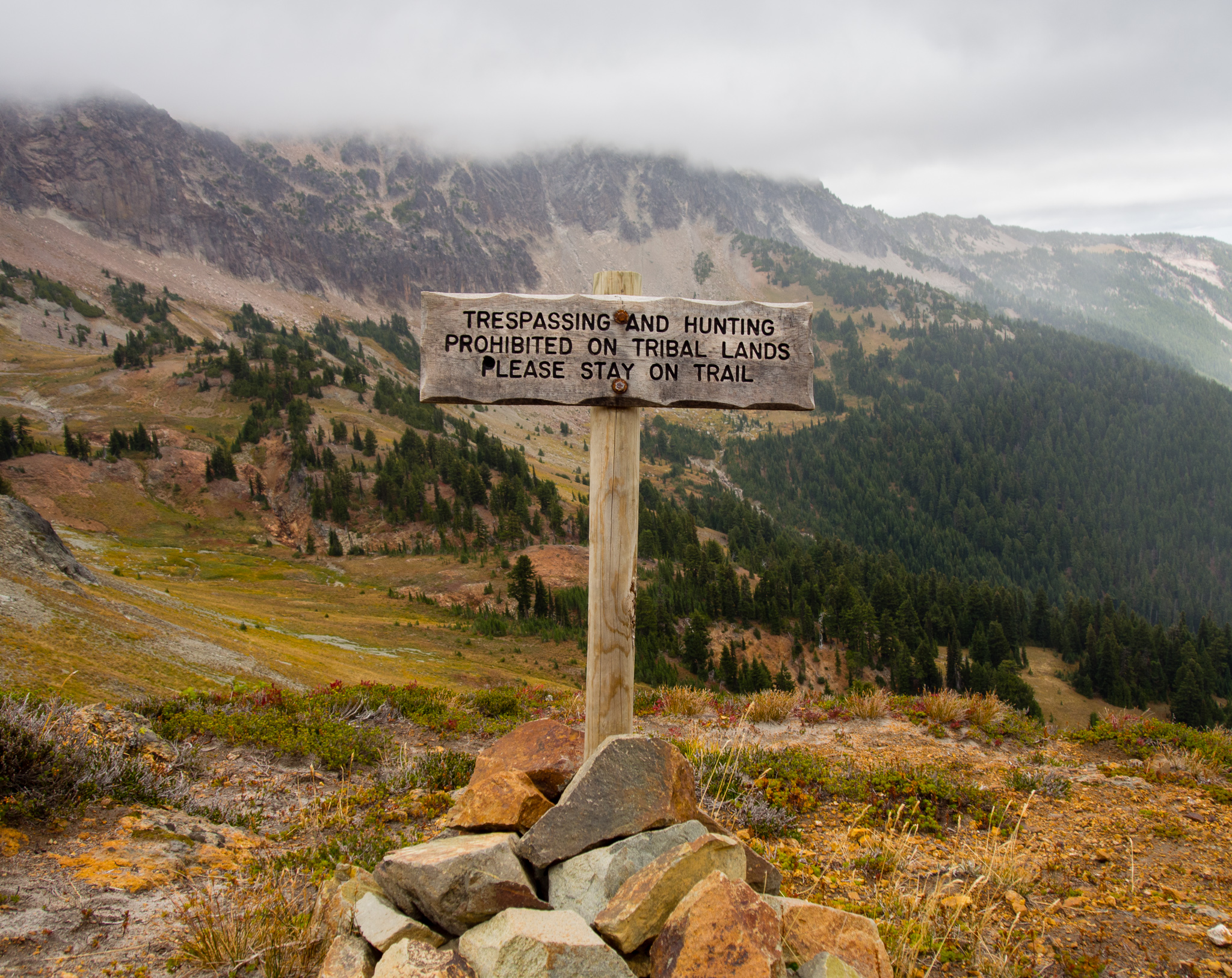
Yakima Reservation
We began to pass other hikers on the trail and I started to worry that it might be hard to find a spot at our destination for the night – Sheep Lake.
One person we passed on the trail was a northbound PCT hiker who had hiked from Bend, OR. She asked me if I was a southbound PCT hiker as I passed her. I took it as compliment and not that I was carrying way too much gear or that I smelled too bad for only being on the trail for one night!
Sheep Lake
When we arrived at Sheep Lake we found most of the sites were taken. We also found a couple of pairs of underwear and copious amounts of toilet paper which was disappointing considering how great of shape Alpine Camp was in. We managed to grab one of the last available established sites. It was on the southwest side of the lake. We sat and watch throngs of other backpackers fill in every flat surface around the tiny lake. Soon our campsite’s toilet area had another group camping in it right next to the piles of toilet paper and pair of boxers some lazy person had left behind. I don’t recommend camping here if you can avoid it.
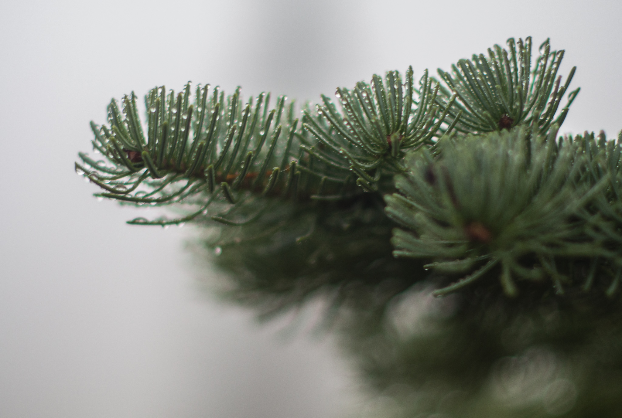
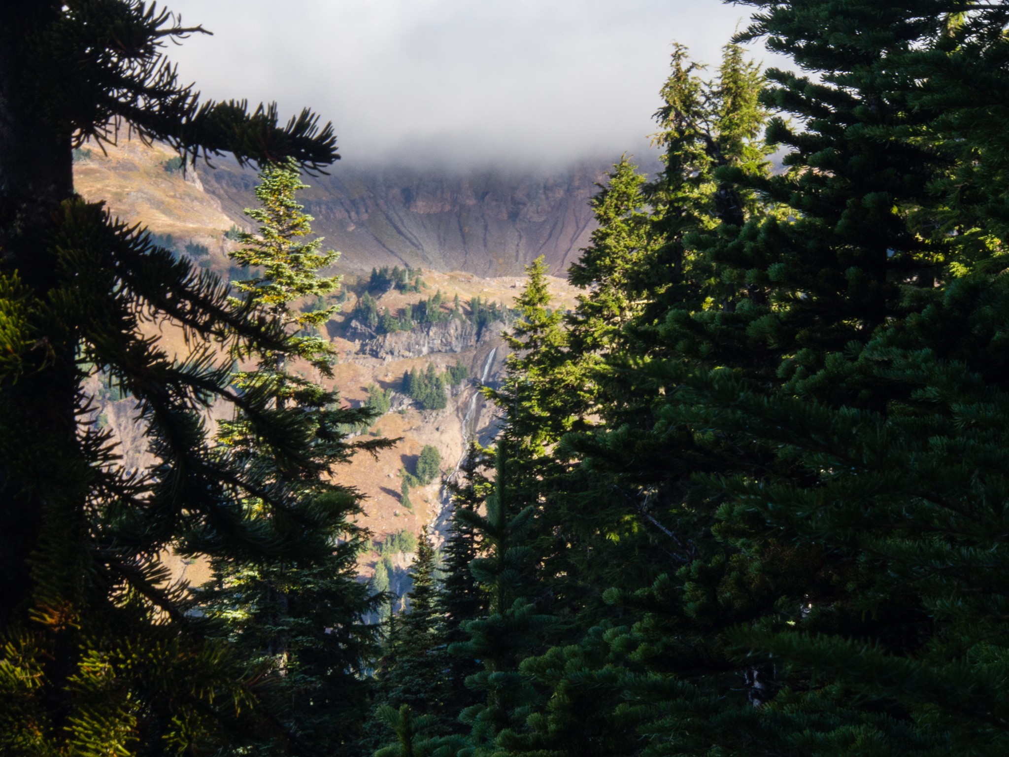
Fog in the trees
Fog rolled in and soon visibility was less than 100 feet. A loud group from across the lake chattered on into the night. There weren’t any stars visible for us that night and both Tom and I zipped our bivies fully closed just in case it started to rain.
During the night I had a recurring dream of unzipping from my bivy and finding myself surrounded by tents only to realize that I’m still dreaming. When I woke in the morning for real no additional tents were found but that loud group across the lake was still chattering loudly.
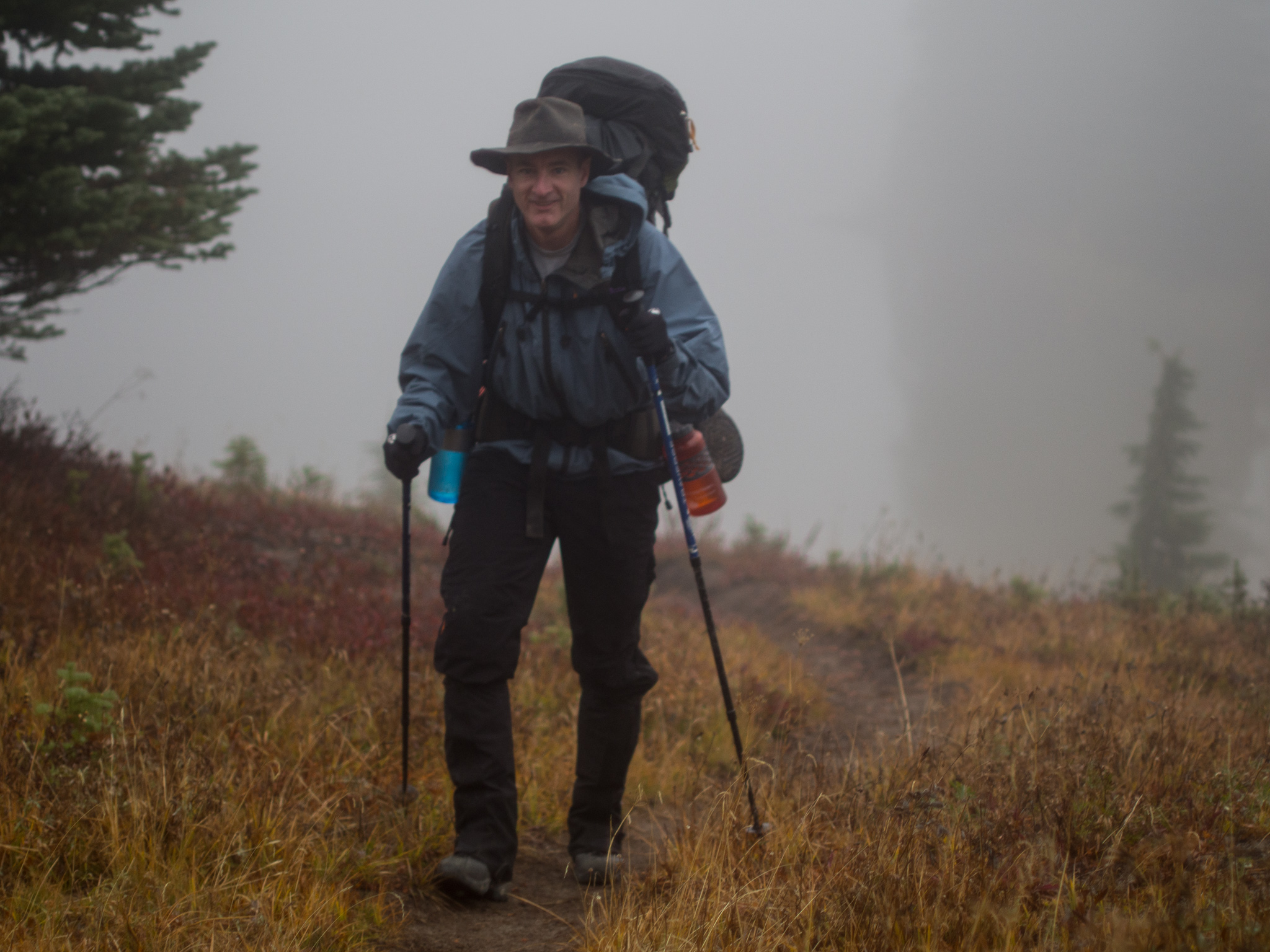
Hiking out in the mist
Tom and I decide to hike out in the mist without breakfast to get away from all the people. We grabbed breakfast in a small meadow, which we later found out had a smaller lake right next door but we couldn’t see it in the fog.
The trail from here went up and down a bit initially which was frustrating for our tired legs. We didn’t take a side trail to a summit on the ridge–Nanny Peak–due to the thick fog, although there were some cool looking cliffs in the vicinity that would be fun to explore. The steep descent to Walupt Lake made us glad we hadn’t hiked the loop counter-clockwise. This part of the trail was in much rougher shape than the trails we had hiked prior. It wouldn’t have been nearly as easy to hike in on in the dark as the Snowgrass Flat trail if we had hiked the loop counter-clockwise.

Walupt Lake
As we descended we eventually emerged from the fog layer and found ourselves at Walupt Lake. There’s a campground and trailhead with latrines and water spigot by the lake. The best way to do this hike would be to have a car shuttle set up at Walupt Lake. But we didn’t have two cars so we had two options: hitchhike or follow a vague description we had for completely the loop on foot and adding 6.5 miles.
The hiking route to complete the loop starts off with walking along the road to just past a horse camp. We decided we’d start walking and try to get a ride from anyone leaving the campground. Unfortunately, we were hiking out early in the morning and we only saw two cars. The first was a pickup truck who drove past apologizing to us and the second had some scary bumper stickers so we didn’t even ask for a ride. After we walked 1.5 miles on the road we came to a sign for Klickitat Trail 7A which by a mishmash of trails and old forest road would bring us back to the Snowgrass Flats trailhead.
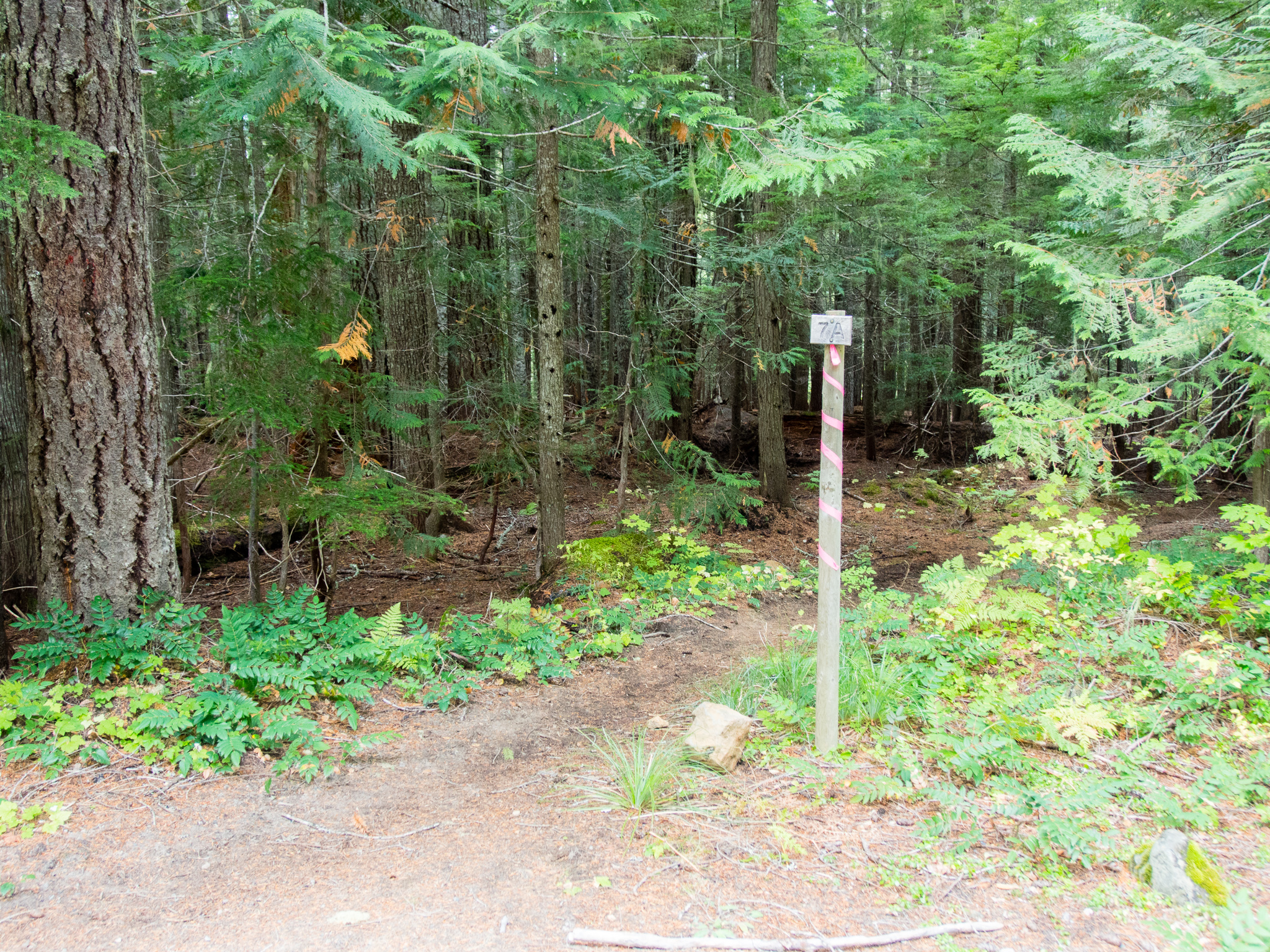
Trail 7A from the road
Re-entering Goat Rocks Wilderness on trail 7A
7A starts in way better shape than we expected. We found ourselves back in the Goat Rocks Wilderness and shortly thereafter fording a shin-deep river. The path was flagged the entire way so it was always obvious where to go, and the route description on WTA ended up being just descriptive enough. I later learned there’s an amazing waterfall upstream from here that I wish we would’ve checked out.
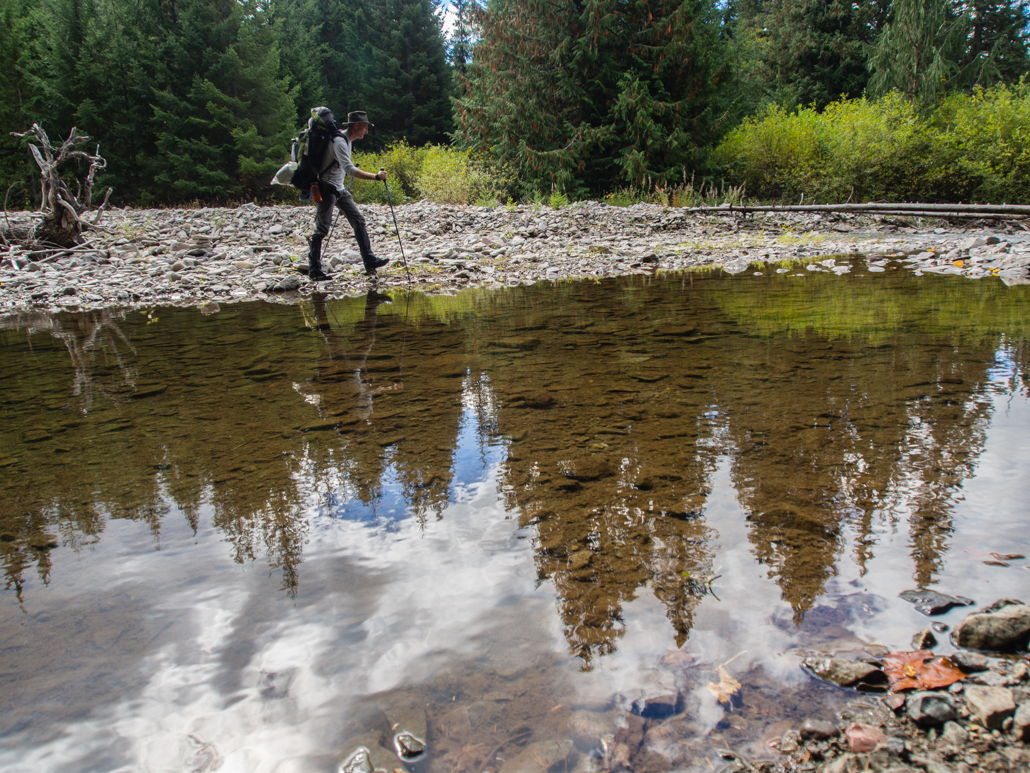
Cispus River Ford
After the river the trail took us through a varied forest. At times it felt like Western Washington while other times it felt like Eastern Washington. Luckily, this meant the 6.5 miles went much faster than I expected it to go. We also kept ourselves entertained by trying to see how many other footprints, horse hoofprints, and tire tracks we could find in the mud. The trail was pretty overgrown at times so it was surprising to see other people had been out here. Even more surprising was that some people had managed to get a dirt bike or a truck on some of the abandoned roads recently. There was an enormous amount of trash and shotgun shells all over the place. Suffice it to say, if you can arrange a shuttle, that would be preferred. The hardest part of the hike back is where the WTA description says to take the last section of trail/road “for some time”. According to my GPS, “for some time” equates to a mile. But it seemed like the longest mile ever!
After this trip I definitely want to get back to the Goat Rocks Wilderness to explore more! I’d love to camp with Maura and Jack in Cispus Basin at that beautiful site nestled at the head of the valley. But, if I were to go back I would do Cispus Basin as a side trip from Snowgrass Flats and then do a loop north on the Lily Basin trail to Goat Lake and out on Goat Ridge instead of going south to Sheep Lake. Taking this other loop would mean you wouldn’t have to arrange a shuttle or walk on trail 7A. Here’s the WTA description for that Snowgrass Flats to Goat Ridge loop.
Next time you visit, search for Walupt Falls, it is truly amazing. Just a bit of a bushwack , only 1.5 miles to the falls.