There’s a trail here somewhere
3:00 pm
“This doesn’t look familiar at all,” I thought as I stumbled along an ever steepening trail. Latigo was pulling hard on his leash as we careened over rocks and roots. “Stop pulling!” I shouted, “You’re going to kill me!” I swore that he was going to pull me right over and I’d smash head first into a boulder. We were 6 miles and almost 4,000 vertical feet into our day hike. I was tired, hungry and severely sunburned. Oh, and we were lost. I mean I had a map and I was following a trail on said map, but I’d been on the planned trail before and whatever steep boot path we were on was definitely not the trail I was familiar with.
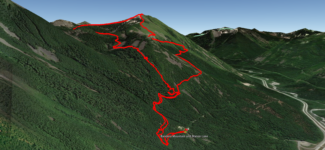
Overview of where we hiked. Jump to the map
Earlier that day – 9:18 am to be exact
I woke up with lofty ambitions of hiking to the summit of the 5,584′ Mount Defiance. Maura is back in Minnesota so I was left to continue training for Ireland alone – well Latigo helped too! Last fall, I had attempted a solo backpacking trip in this same area but ultimately had to turn around due to deep snow. This time I threw a pair of snowshoes into my pack just in case and we loaded into the car.
10:27 am
Latigo and I pulled into the parking lot for the Ira Spring trail which would lead us to Mount Defiance after a junction at Mason Lake. The trail to the summit of Mount Defiance is 11 miles and gains over 3,300 vertical feet. The sun was shining and it was already quite warm. I threw all of my layers into my pack and converted my pants into shorts. Then I realized I’d neglected to pack sunscreen or a hat. I figured I’d probably live to regret forgetting sunscreen but I’d already driven over 40 miles to the trailhead and there was no point in turning back now.
There were about 15 cars in the parking lot and in the first mile of the hike we passed a number of parties. Quite the contrast to when I had been on this trail late last fall when I only saw 1 other person the entire day. I had read online that the river crossing was really dangerous right now and I encountered one couple and their dog on the way up who had turned around at the crossing.
I was a little nervous about crossing the river since if you were to be swept away you’d find yourself taking a nice trip down a waterfall. Past hikers had left a rope strung across the river as a handline and an attempt at a makeshift bridge left a few rotten logs stuck in the rapids. I took a step onto one of the logs with my hand firmly grasping the handline and my stomach sank when a loud crack emitted from the log beneath my foot. Nowhere to go but forward so I moved quickly and shuffled across a couple of rocks and found myself dry and unharmed on the other side of the crossing. Latigo swam across with no fear – until the current made it difficult for him to get his legs out of the water. Once I hoisted him out he had a huge smile so I don’t think he was too phased.
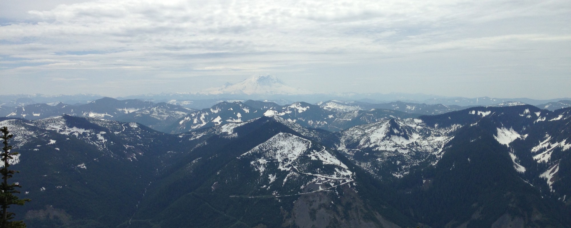
The first of many views of Rainier from the trail
The trail continues on for a while at a moderately steep grade. Maura and I have been hiking a lot of flatter and longer hikes lately so it was a bit of a shock to my system to be gaining so much elevation. Soon I was dripping in sweat and huffing and puffing. But it wasn’t long before I was rewarded by some awesome views of Rainier peaking out.
11:36 am
At around 3600 feet I started encountering snow. The first bit of snow was over a large talus field and there were bootprints cutting a switchback. I kicked my way up and post-holed a couple of times so I threw on my gaiters and micro-spikes to keep the snow out of my shoes and to gain some traction on the steep inclines. Soon I came to the split in the trail. I could go left and continue to my goal of summiting Mount Defiance or I could go right and summit Bandera Mountain. Looking towards the trail to Mount Defiance I saw a sketchy looking snow field that would surely spit me down into some painful looking rocks. There were also no visible footprints in that direction. Looking towards Bandera I saw plenty of sunshine and a remarkably snow-free trail with lots of smiling happy people. I decided to change my goal and head towards Bandera.

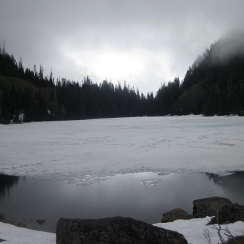
Latigo cools off in the snow while I eat
At this point the trail became less of a path and more of a scramble. I let Latigo off-leash so I could have my hands free to help scale the hill side. After quickly gaining around 600 feet of elevation gain I was greeted with a beautiful view into the Alpine Lakes Wilderness on the other side of the ridge. On the ridge the snow was about 8 feet deep and a descent sized cornice had formed over the ridge so we were careful to not get too close. We entered a grove of trees and we laid in the shaded snow for a while to eat lunch.
12:58 pm
After eating lunch we continued our way through the snow. At times it got pretty steep but there was a really good path set by the boots of hikers from earlier in the day. We followed the ridge as it leads towards the false summit of Bandera Mountain. We attempted to get to the true summit further down the ridge but the snow was getting really soft and I was slipping around. It wasn’t worth the risk.
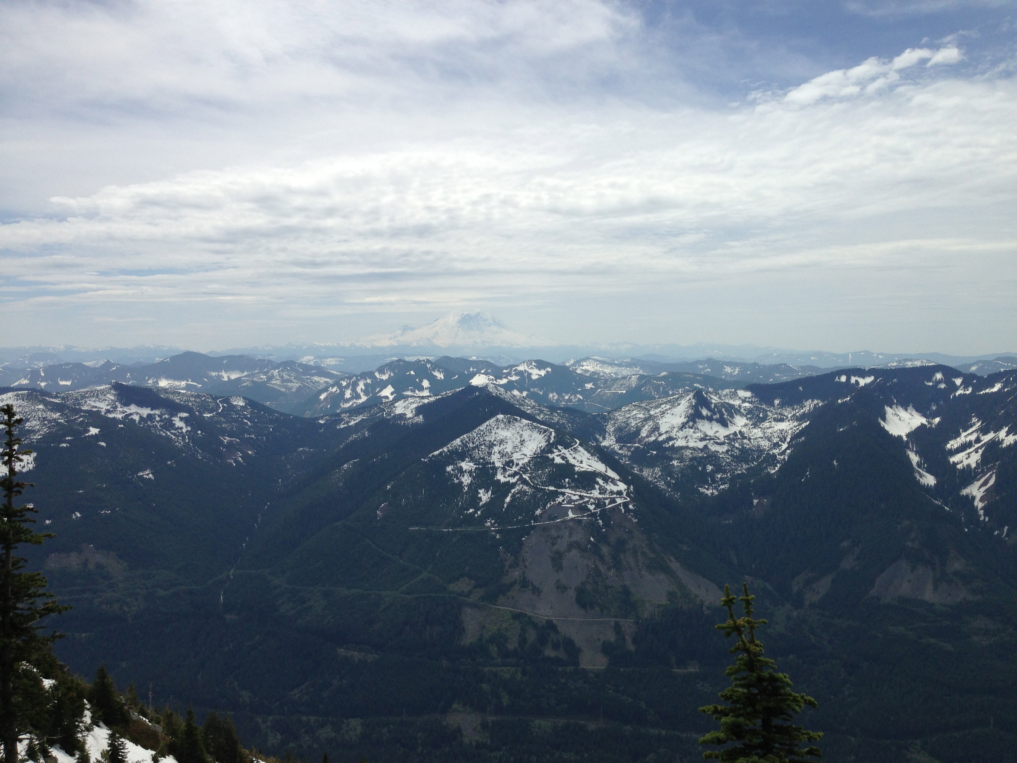
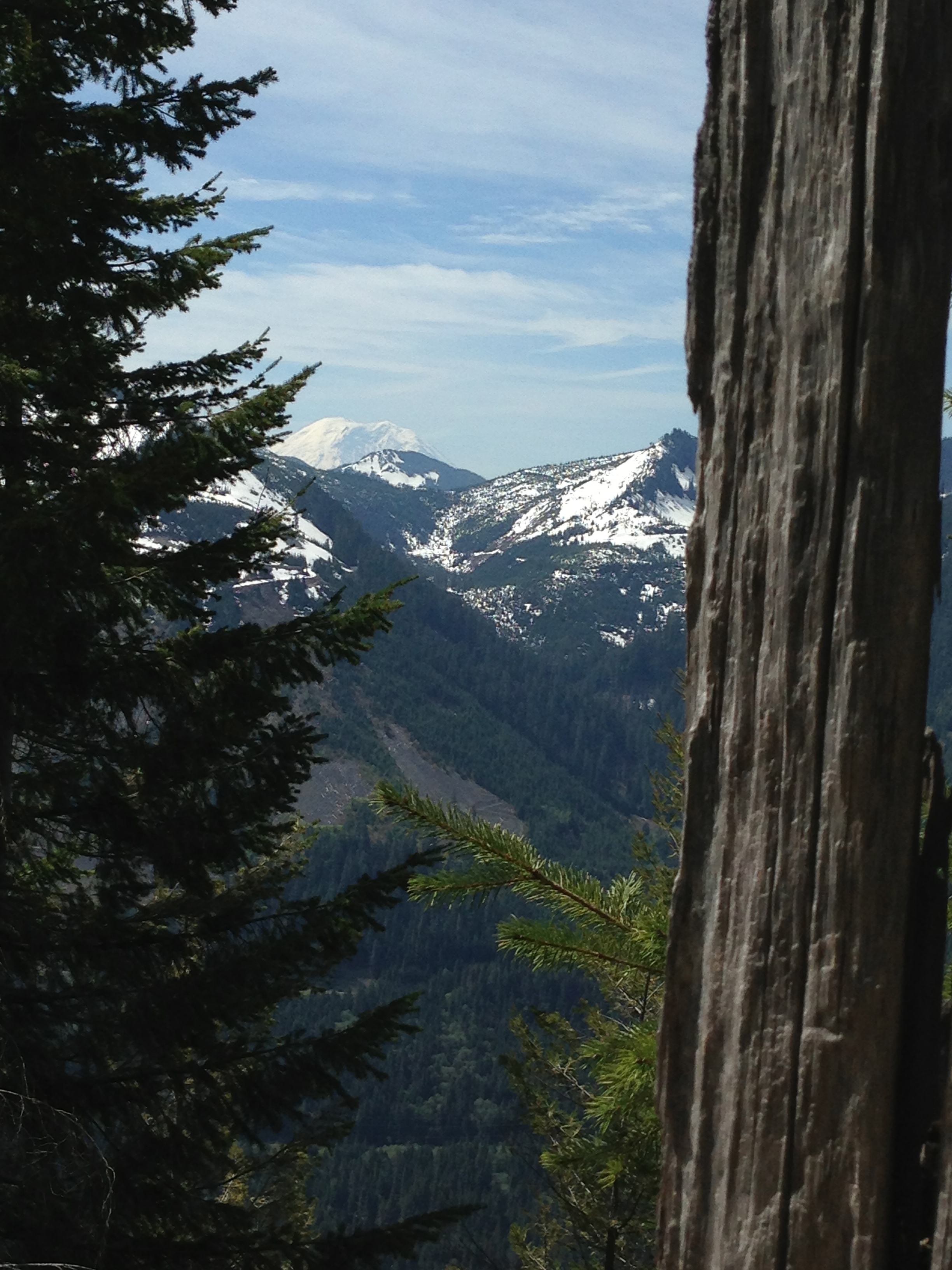
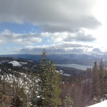
View across the I-90 corridor
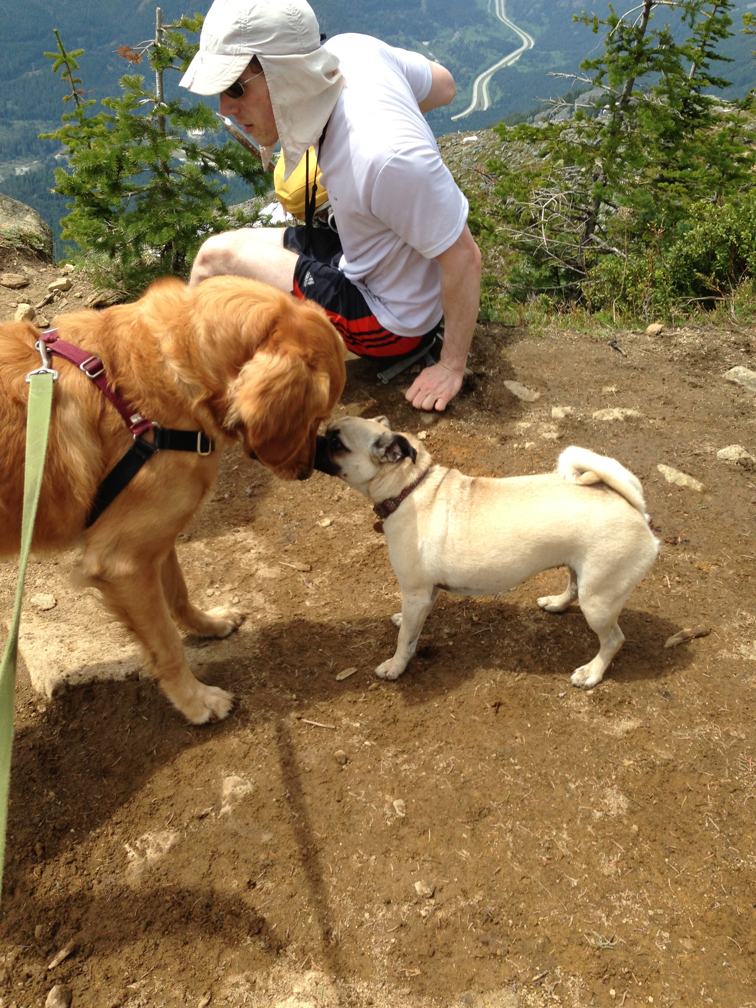
Latigo’s meets a new friend at the summit
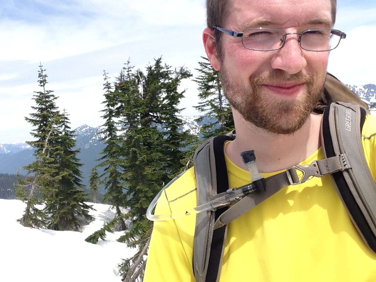
Summit Self-portrait
1:19 pm
There were about 10 people resting at the summit when I arrived. It was pretty busy considering there was only a really small area not covered in snow for people to sit in. Latigo played with a little pug for a while which was quite entertaining. My favorite part was when Latigo was chewing on a stick he found and the pug snatched it from him and disappeared behind a rock to eat it himself. Poor submissive Latigo. It was time to head down but I wasn’t content with the day. I had set out with ambitions of doing an 11 mile hike and I was on track of completing only ~6 miles. The trail was also a little too crowded for my tastes.
A few months back I had read a trip report where someone had hiked from nearby Mason Lake to the top of Bandera via a gently inclined ridge. On my map I could see where this ridge was so I figured we could give it a shot and loop around Mason Lake and connect back up to the Ira Spring trail in a few miles. I thought it would be fun to practice navigating without the aid of an established trail while being in an area that I was semi-familar with (I had hiked to Mason Lake last fall after all).
1:38 pm
The ridge that I was too follow started really close to Bandera’s false summit. I hesitated a moment before committing to this new route. I was worried that we might run into steep snow and I wouldn’t be comfortable going down it and we’d end up having to climb back up to where we were. But after reconsulting the map, I was confident that the ridge would be easy and I’d be down to Mason Lake in a matter of minutes. Latigo and I started our way down the undulating ridge. At times we’d find ourselves more skiing down than hiking down! Whenever the snow got too steep I’d force us to do little switchbacks to keep our footing solid. Latigo kept wanting to chase the snowballs that would form from the loose snow that would roll out from kicking steps. A couple of times he almost pulled me over with his lunges. I didn’t want to let him off leash for fear of him falling in a tree well or doing something stupid.
2:01 pm
My GPS started acting up. I’d open it up to figure out if we were still going the right direction and it would show us as standing in the middle of a lake a quarter mile away. I knew that couldn’t be true and after restarting the app it would show the correct location. Now the GPS said we were close to intersecting the lower trail past Mason Lake but I couldn’t see any signs of a trail anywhere. Since everything was covered in snow I was on the lookout for other signs of a trail like blown down trees that were cut. But nothing. We went down some steep, densely forested snow and I felt like we were getting to close to a different lake. I checked the GPS again to find that we had overshot the trail. “But how could that be? We’d barely gone anywhere and there was no sign of a trail,” I thought. Rather than backtracking I oriented us on a path to bisect the trail further down. We followed the contours of the topographic map until finally the GPS showed us on top of the path. I could see the faint indents of a pair of boots in the snow so I decided to follow them. But soon they led me astray and I was back to pulling out my phone and using the GPS to follow the dotted line of the trail.
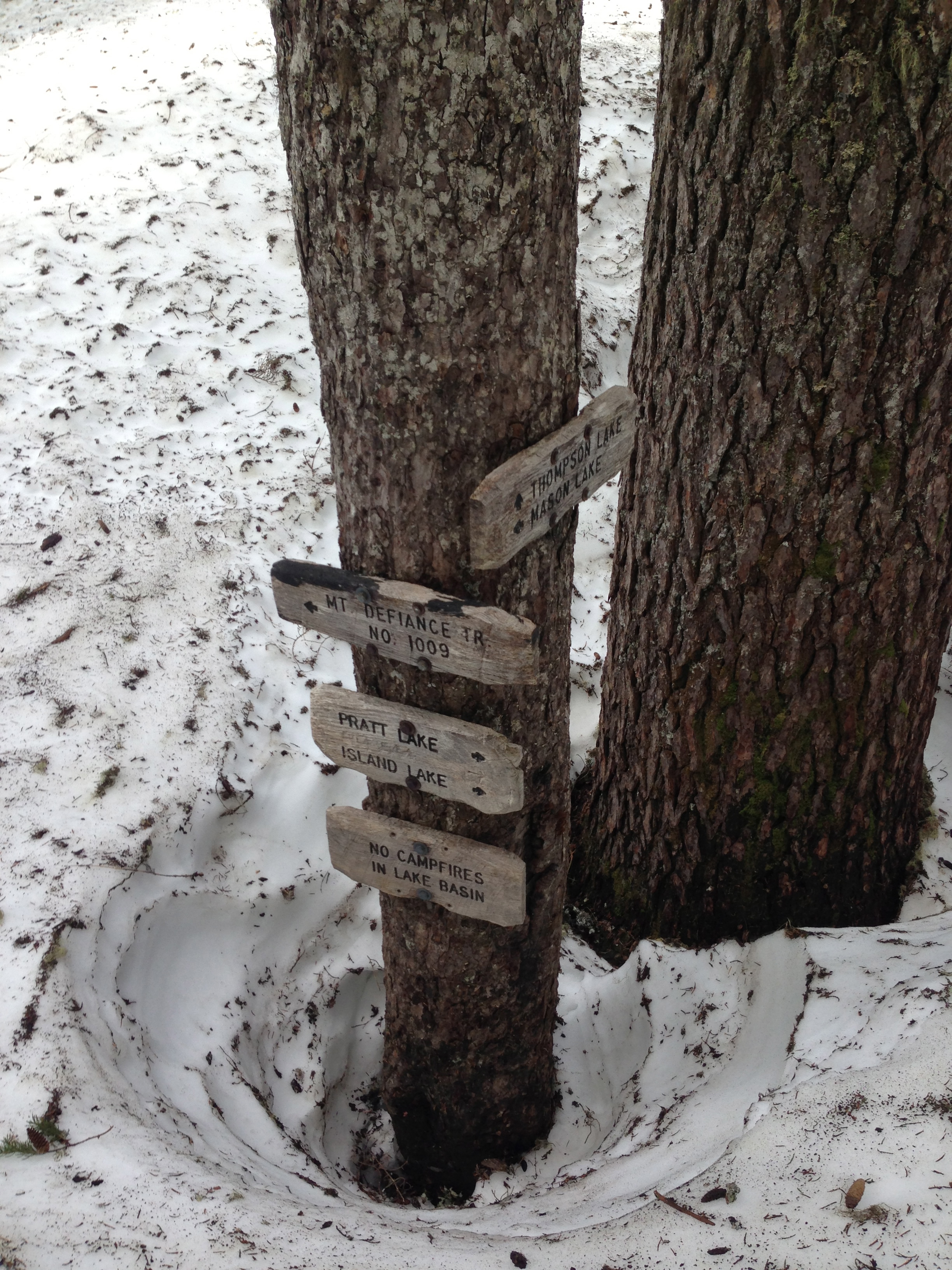
A familiar trail junction
2:18 pm
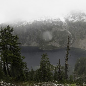
Finally I recognized something on the trail! We came across the trail junction where the Mason Lake trail forks. If I had continued with my original plan to go to Mt Defiance I would’ve been at this junction hours earlier. But I was really glad that I hadn’t gone this way considering how difficult wayfinding was with no path to follow. I managed to find some other bootprints to follow as we skirted around the western shore of Mason Lake. I played back images of where the trail went from my trip last fall and happened across the place I had cooked my lunch before. Except this time I could only stand on top of that place since it was covered in 6 feet of snow.
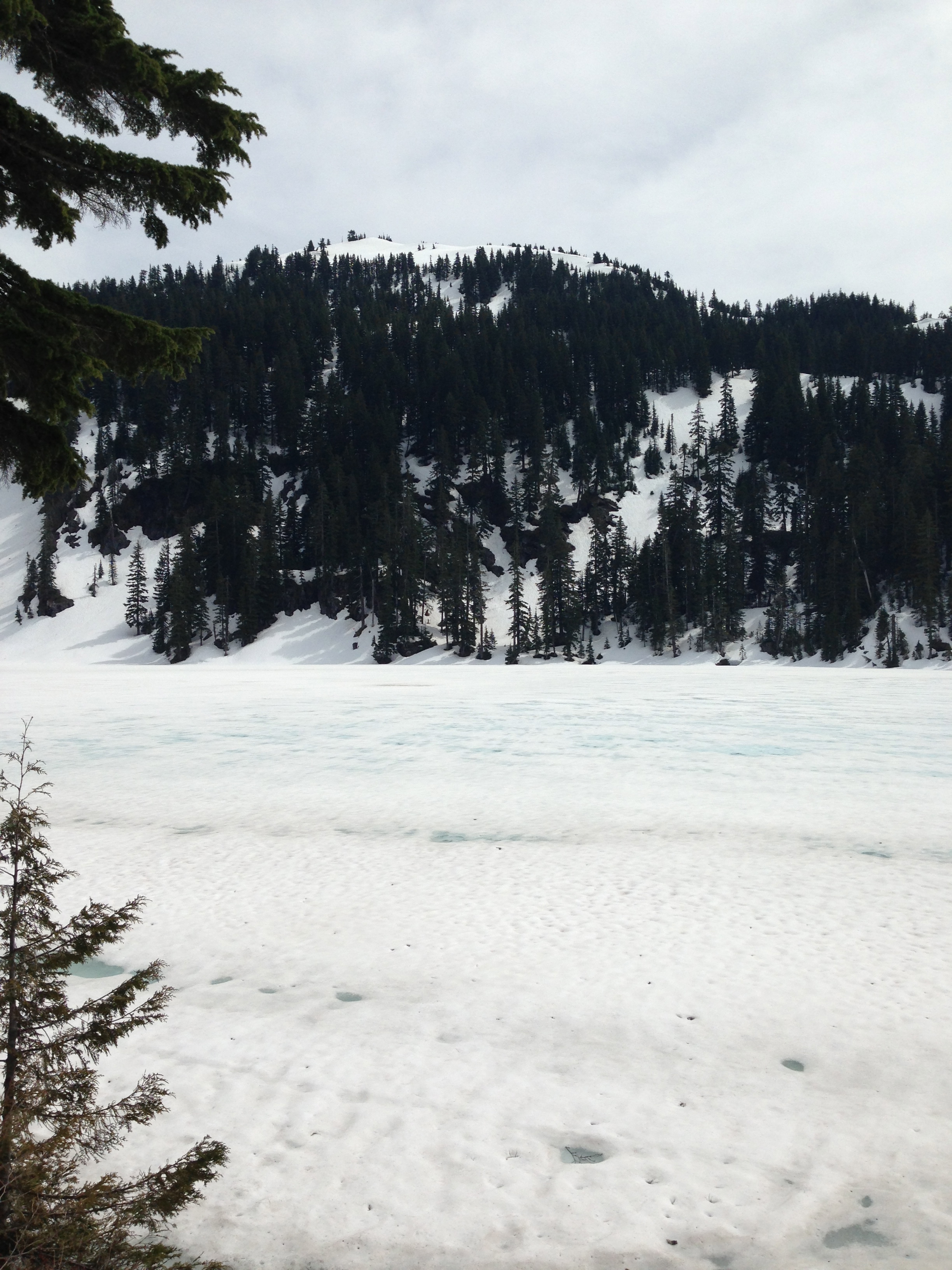
Mason Lake. The peak is the highpoint of Bandera Mountain that I reached. We then followed the ridge to the left of that point down.
2:25 pm
We followed the lake to where the trail crosses a creek at the lake’s mouth. This gentle creek is what becomes the roaring river that is the cause of the scary river crossing at the beginning of the trail. At the junction I found boot prints going off in 3 different directions. Thanks past hikers … So we followed the direction of the boots that went the way that I remembered the trail going last year. It also aligned with the trail that my forest service maps showed. The boot prints kept disappearing and reappearing and then they’d go off in a random direction for a while. I was pretty confident that whoever laid these prints didn’t have a good idea of where they were going but eventually the snow retreated and we found ourselves on some semblance of a trail.
2:47 pm
Then the trail dead ended against a giant talus field covered with snow. It was late in the afternoon so the snow was very soft and I didn’t feel like breaking my leg if I was to crash through the snow to the talus below. I triple checked the GPS and I was certain that if I crossed this snow it would put me back on the trail. Luckily I had been carrying snowshoes in my pack all day and they’d keep me on top of the snow. I strapped the shoes on and across the snow we went. It was nice having all of that extra weight out of my pack too!
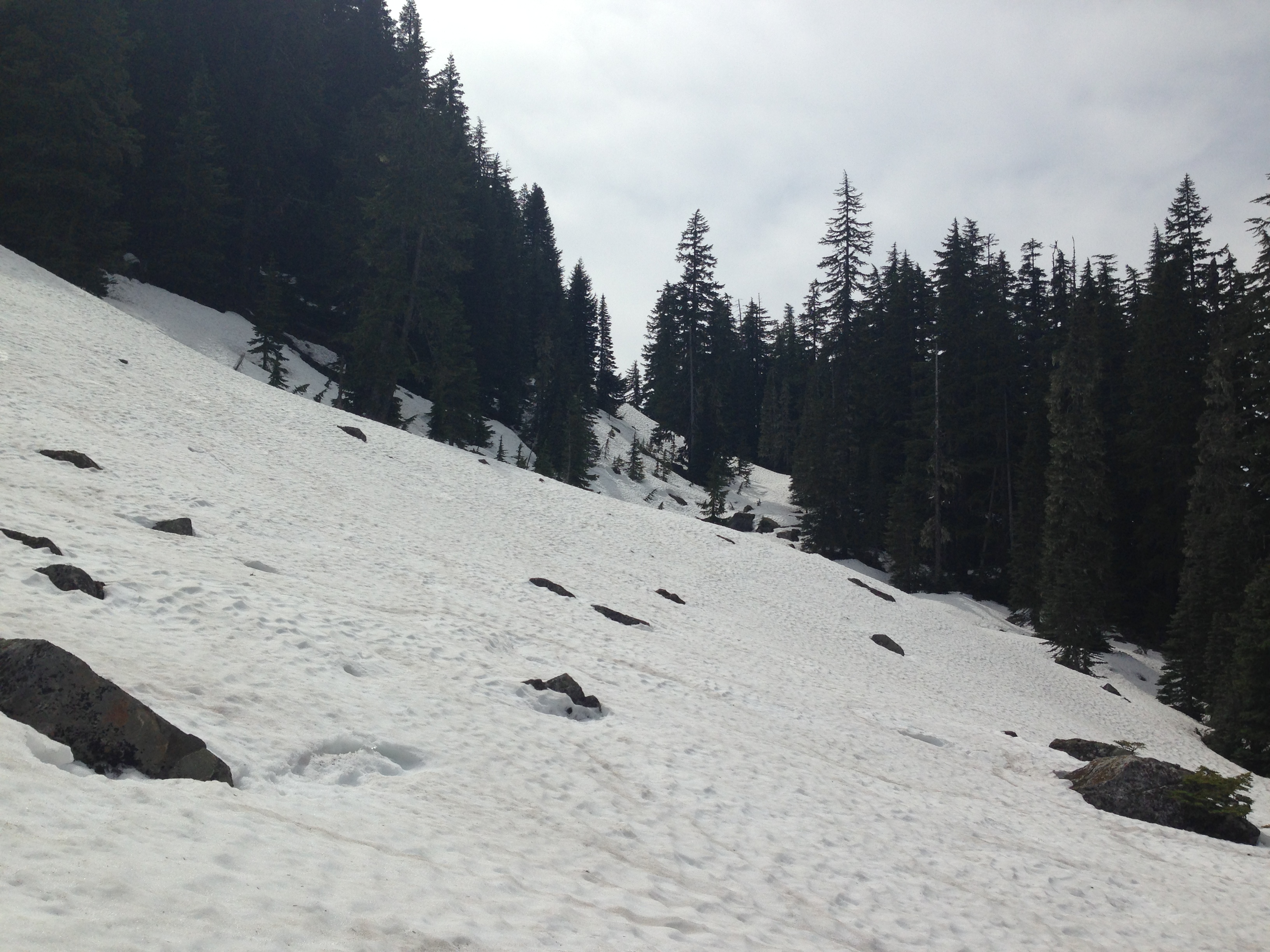
The talus field that promised me access to the trail
2:56 pm
We successfully crossed the talus field and I even found another set of bootprints to follow halfway across. Plus, I only fell in once! Latigo did great and chased around some sort of a mammal for a while. But I still didn’t recognize where I was. I couldn’t match any of the scenery to that hike I had done last year. But the forest service map said I was right on the trail so we kept on hiking. The snow disappeared immediately after the talus field so I took off my snowshoes and carried them in preparation for more snow. But it never came.
Back to 3:00 pm
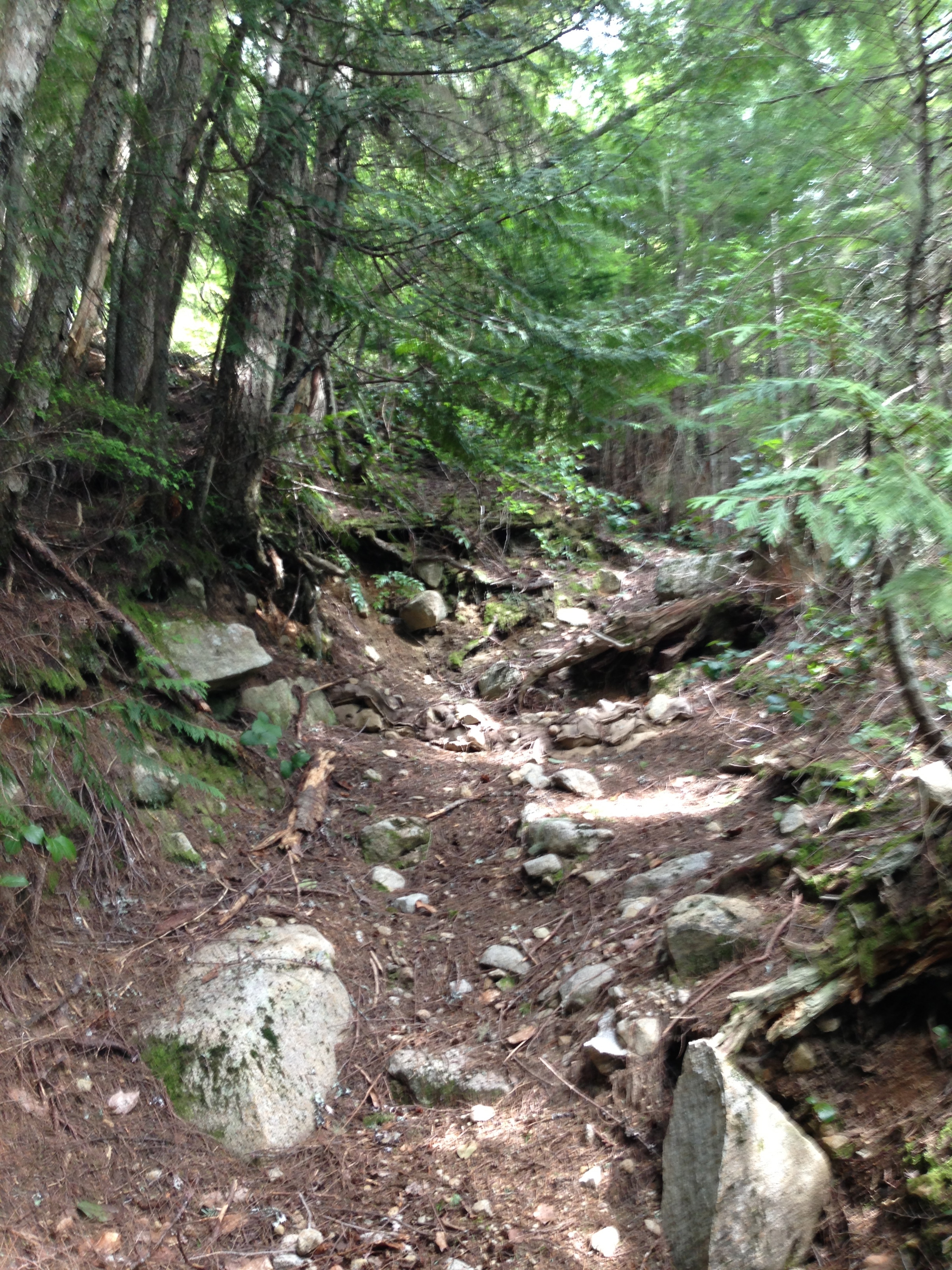
The snow never came back. I kept waiting for the scary snow crossing I would have to do (the one that I avoided by going to the trail toward Bandera Mountain instead of towards Mason Lake/Mount Defiance in the beginning of the day). Instead we were just trekking down steep barely there trails. At times I couldn’t figure out if we were on a trail or if the forest just didn’t have very much understory at that spot. Down trees were across the trail everywhere and there were rare signs of any other people having used this trail. We kept walking along, following that dotted line on the map.
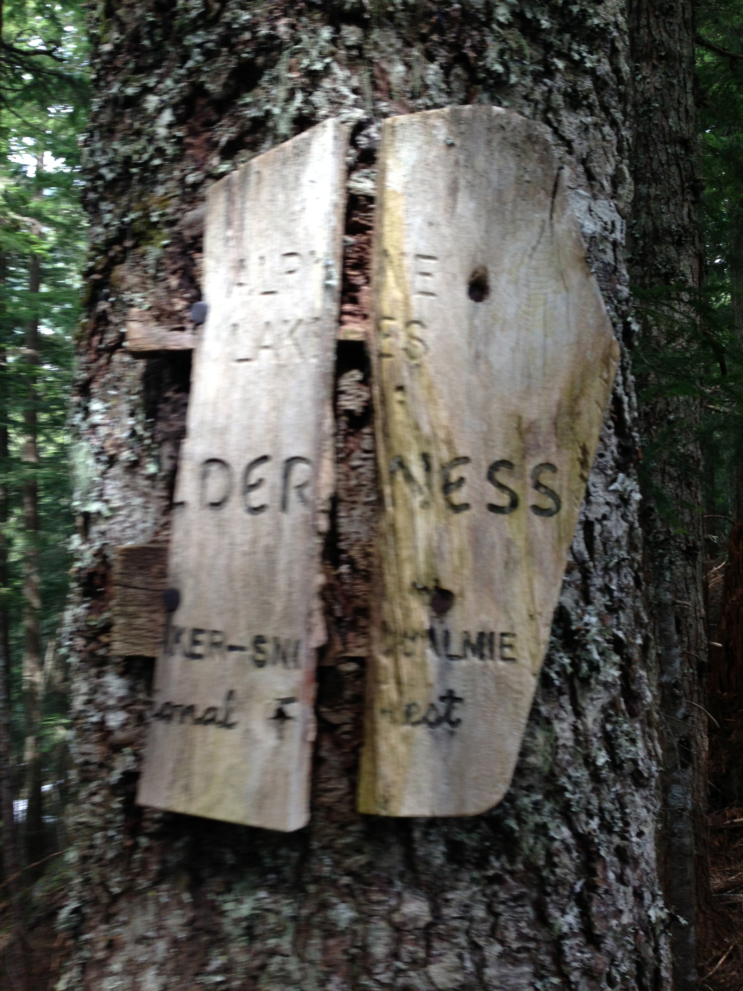
A really old Alpine Lakes Wilderness sign.
We came across other hints that we were on a trail. At one point we wandered past a really beat up Alpine Lakes Wilderness sign and eventually the trail met up with a different trail and become a lot more defined. Suddenly there were logs lining the trail to curb erosion and water drainage had been dug. Then we entered a short series of switchbacks. I found it humorous that we had just descended 1,000 feet on a stupidly steep trail only to have switchbacks for the final 200 vertical feet.
And then suddenly everything came together. We were spit out onto the main Ira Spring trail right next to the scary river crossing. My old forest map had an old forest trail up to Mason Lake that is no longer maintained! I guess I should figure out how to get newer forest maps on my phone, although it’s pretty cool to have found that old trail. I’m just glad we went down it instead of up it!
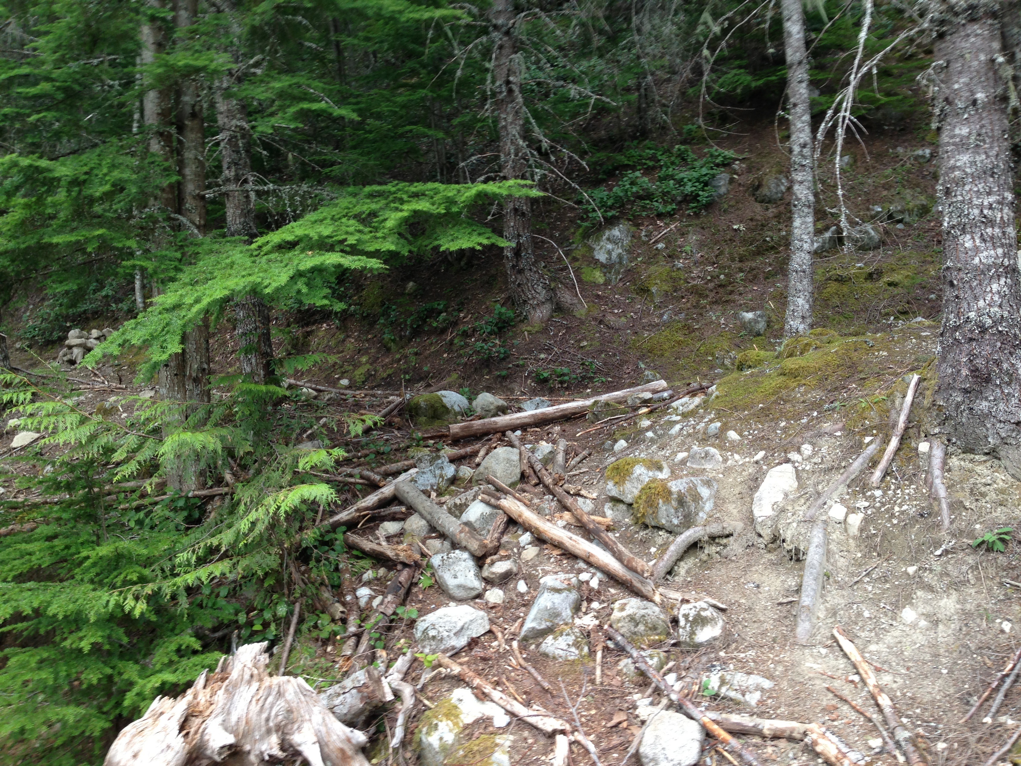
The entrance to the old Mason Lake trail from the Ira Spring trail
3:26 pm
We’d managed to inadvertently take a pretty huge shortcut and avoided a lot of the steep snow descent higher up on the Bandera Mountain/Ira Spring trail. We crossed the river again. The handrail was now gone but people had added a number of new logs which made crossing a lot easier. We kept a good pace of 4mph on the final leg of the trail back to the car. I was super hungry and I could feel my sunburn setting in.
3:44pm
When I got to the car I ran into a number of the people I was with atop Bandera Mountain. I ended up not only getting a mountain top view, but I also got to do a little lake hike and get back to the car in about the same time it takes to descend Bandera via the normal route.
Now all that’s left to do is to apply some more Aloe Vera!

Ouch!
If you’re interested in more of the history of the old Mason Lake trail here’s a good article: http://www.seattlepi.com/news/article/Hike-Of-The-Week-New-trail-is-a-hiker-friendly-1123886.php
When I lived north of Seattle I remember we hiked up to Mt Ranier basecamp area in July to have a snowball fight. Have you ever been up Wagon Wheel which is a Native American sacred sight with a marvelous view. If you get down the northwest coast a hike in the Redwoods at Richardson Grove or Lady Bird Johnson Grove is well worth it. My husband Paul grew up in that area. Shelter Cove, Ca down to Fort Bragg along the coast is nice and a place in the state park to ride horses on the beach. From Fort Bragg you can take the skunk train up the mountain to Willits. We have done a bit of hiking. Enjoy while your young. I remember our daughter Jill at about age 7 made it to the top of Leveaux Mtn on the North Shore and signed her little name on the register when she made it out of the fern forest and to the top. One of my favorites before everyone knew amount it was Oberg mountain in the same area.